Finding a reliable GPS tailored for trucks means focusing on routing that accounts for vehicle size, weight, and road restrictions. The following devices combine large displays, truck-specific routing, real-time data, and Birdseye imagery to help drivers plan efficient trips while avoiding delays at weigh stations, low bridges, or tight truck docks. This guide highlights five of the best options currently available from Garmin and other reputable brands, comparing features and practical use cases for American fleets and long-haul drivers.
Summary Of Chosen Products
| Product | Brand | Display | Key Truck Features |
|---|---|---|---|
| Garmin dezl OTR720 | Garmin | 7 inches | Custom truck routing, bridge height alerts, loading dock imagery, Birdseye satellite view |
| Garmin dezl OTR620 | Garmin | 6 inches | Truck routing, loading docks, security gates, Birdseye imagery |
| Garmin dezl OTR610 | Garmin | 6 inches | Custom routing, loading dock views, satellite imagery |
| Garmin Dezl OTR1010 | Garmin | 10 inches | Large display, custom routing, Birdseye imagery, truck/trailer services |
| Garmin Dezl OTR500 | Garmin | 5.5 inches | Truck routing, weigh-station alerts, dock guidance |
Garmin dezl OTR720: Large 7″ Truck Navigator
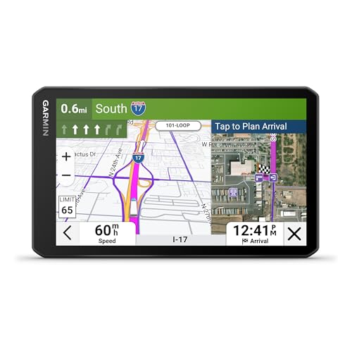
The dezl OTR720 provides a bright 7-inch touchscreen designed for in-cab viewing and easy visibility on the road. It supports custom truck routing based on truck size and weight (availability varies by area and current conditions). Drivers receive alerts for upcoming bridge heights and sharp curves, and the device helps you approach loading docks and security gates with improved planning. BirdsEye Direct Satellite Imagery offers high-resolution overhead views of destinations to assist arrival planning.
Garmin dezl OTR620: 6″ Truck Navigator

The dezl OTR620 offers a compact 6-inch display with clear, high-resolution visuals for cab use. It includes custom truck routing based on vehicle size and weight, with alerts for bridge heights and sharp curves. It helps you approach loading docks, entrances, and security gates smoothly, while BirdsEye Direct Satellite Imagery provides overhead views to assist destination planning and arrival times.
Garmin dezl OTR610: Large 6″ Truck Navigator

The dezl OTR610 focuses on reliable truck routing and a bright 6-inch display. It provides alerts for bridge heights, weight limits, and sharp curves, enabling safer navigation. BirdsEye Satellite Imagery offers high-resolution aerial views of loading docks, truck entrances, and security gates for destination readiness. Availability of some features may vary by region and current routes.
Garmin Dezl OTR1010: 10″ Truck Navigator
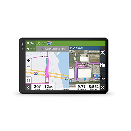
The Dezl OTR1010 features a 10-inch touchscreen for expansive cab visibility and easy control. It supports custom truck routing based on size and weight, with alerts for bridge heights, weight limits, sharp curves, and steep grades. BirdsEye Satellite Imagery delivers high-resolution aerial views of loading docks and security gates to aid arrival planning and dock access. This model emphasizes large-screen ergonomics and comprehensive truck-focused planning.
Garmin Dezl OTR500: 5.5″ Truck Navigator

The Dezl OTR500 offers a compact, easy-to-read 5.5-inch touchscreen with truck routing tailored to vehicle size and weight. It includes notifications for weigh stations and bypass options, plus road-height and curve alerts. The device provides guidance to loading docks and other critical truck-access points, helping drivers manage routes efficiently in smaller cab spaces.
Buying Guide: Key Purchase Considerations
- Display size and readability: Larger screens (7–10 inches) reduce scrolling and improve in-cab visibility, especially on long hauls or in low-light conditions.
- Truck-specific routing: Look for devices that let you input vehicle height, weight, length, and axle count to tailor routes and avoid restricted roads.
- Real-time data and alerts: Bridge heights, weight limits, sharp curves, and red-light/sh speed-camera warnings help prevent delays and fines.
- BirdsEye/Satellite imagery and dock access: High-resolution overhead views of destinations, loading docks, and security gates facilitate precise arrivals and dock scheduling.
- Map updates and lifetime support: Free lifetime maps reduce ongoing costs and keep routes accurate across North America and beyond where applicable.
- Platform flexibility: Some models offer broader regional coverage (US/Canada/Mexico) and optional European maps, expanding long-haul options for cross-border drivers.
- User interface and ease of use: A responsive touchscreen, accessible menus, and clear audible guidance improve safety and reduce distraction.
- Compatibility with services: Built-in PrePass-like bypass notifications and trailer services can save time at weigh stations and optimize trips.
Multiple Perspectives on Choosing a Truck GPS
- Fleet operators may prioritize large-screen models with advanced routing and centralized map updates to streamline dispatch planning.
- Owner-operators often value compact devices with strong dock-to-dock guidance and reliable alert systems to avoid costly route restrictions.
- Regional drivers focusing on cross-border trips should consider maps with North American coverage and easy access to updates for all regions.
- Drivers seeking ease of use may prefer devices with Birdseye imagery and intuitive interfaces to minimize training time.